团期与价格
同行价格信息仅对签约同业客户开放。
登录后查看同行价行程文档
英语行程
13 Days Silk Road Group Tour from Kashgar to Xining (Xinjiang/Gansu/Qinghai)
Day 1 · Kashgar, Xinjiang Arrival | Pick-up and Hotel Check-in
Overview: Welcome to Kashgar. Arrive in Kashgar by flight or train. Explore on your own.
Attractions: free exploration
Activities: coach
Accommodation: Kashgar
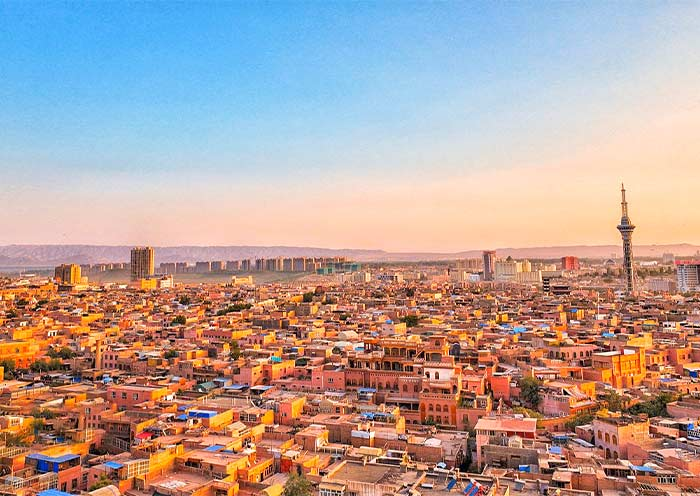
Ni Hao! Welcome to Kashgar, the westernmost frontier city in China, known as a dazzling jewel on the ancient Silk Road. Upon your arrival at Kashgar airport, your tour guide and driver will greet you at the exit. They'll then escort you directly to the downtown area and assist you with checking in at your hotel. Note: We recommend choosing a morning flight to Kashgar, as you'll need to apply for a border permit in advance (office hours: 10:30 AM–6:00 PM). This permit is required for entering border areas such as Tashkurgan County and the Pamir Plateau on the second day. Kashgar (喀什), located in the southwestern part of Xinjiang, was historically known as Shule ( (疏勒国), and was one of the thirty-six kingdoms of the Western Regions (西域三十六国). For centuries, Kashgar has been a significant city in southern Xinjiang. It served as the western terminus for the northern, central, and southern routes of the ancient Silk Road, connecting Europe and Asia. It has long been a transportation hub and distribution center for goods between East and West. Trade is highly developed here, earning it the title of "Kingdom of Bazaars (markets)." Diverse cultures from Asia and Europe converge on Kashgar, clashing and blending intensely with the local culture, injecting new vitality into Kashgar. This cultural fusion is specifically reflected in Kashgar Old City's architecture, cuisine, and vibrant markets. The city has always been a melting pot of various ethnic groups, including Uyghurs, Han Chinese, Tajiks, and other nationalities. Additionally, located at the junction of the Pamir Plateau and the Tarim Basin, Kashgar also serves as a gateway to some stunning natural landscapes. Kashgar Arrival Ideas: By Air: Kashgar International Airport (IATA: KHG, ICAO: ZWSH) is one of China's westernmost airports. Domestic flights connect Kashgar to major Chinese cities, including:Urumqi (about 2 hours), Lanzhou (about 4 hours), Beijing (about 6 hours), Shanghai (about 7 hours), Xi'an (about 5 hours), Chengdu (about 5 hours), and Guangzhou (about 7 hours). Some international flights from nearby Central Asian countries may also fly into Kashgar. From Borders: The Torugart Pass and Irkeshtam Pass are important channels between China and Kyrgyzstan. The Karasu Port is a crucial gateway between China and Tajikistan. The Khunjerab Pass is the only land border crossing between China and Pakistan. If you plan to arrive via a land border, please contact your travel advisor for specific costs and arrangements.
Day 2 · Kashgar - China-Pakistan Highway - Tashkurgan | Pamir Plateau, Baisha Lake, Karakul Lake
Overview: Embark on an exhilarating road trip along the China-Pakistan Highway to Tashkurgan. (B)
Attractions: 2 sites
Activities: coach
Meals: Breakfast
Accommodation: Tashkurgan
This morning, your guide and driver will pick you up from your hotel in Kashgar to embark on an exhilarating road trip along the China-Pakistan Highway. Along the way, you can enjoy the beautiful landscape of Pamirs Plateau, visit Baisha Lake and Karakul Lake, admire the distant and mysterious Muztagh Ata Peak, Kongur Tagh, Kongur Tiube, and conclude in Tashkurgan. (Total distance: 300 kilometers, approximately 7-8 hours of travel) The China-Pakistan Highway (中巴公路), also known as theKarakoram Highway (KKH), is one of the world's highest paved international roads. It connects China and Pakistan across the Pamir Plateau (帕米尔高原) and is locally referred to as the Pamir Highway. Historically, routes across the Pamir Plateau - known as Congling (葱岭) in ancient times - were vital parts of the Silk Road. This section posed one of the most daunting challenges for merchants and travelers due to its harsh, rugged terrain. Here, several of the world's renowned mountain ranges - the Himalayas, the Karakoram, the Kunlun Mountains, the Tianshan Mountains, and the Hindu Kush - converge and radiate outward, forming a massive mountainous junction. Today, the China-Pakistan Highway has transformed these perilous trade routes of the past into magnificent thoroughfares, attracting numerous tourists to the Pamir Plateau to experience its stunning natural scenery. Along the way, you will visit the following attractions: Baisha Mountain-Baisha Lake Scenic Area (白沙山-白沙湖景区): As you drive along National Highway G314, you'll encounter Baisha Lake (白沙湖) , also known as Bulunkou Lake - a striking plateau lake nestled in the Pamir Plateau (elevation:about 3,660 meters). From its shore, you're treated to a stunning vista: half pristine blue water, and half white sand mountain, both harmonizing with distant snow-capped peaks to create a magnificent spectacle. On the lake's northern shore stands the renowned Baisha Mountain (白沙山), winding for over 1,200 meters. The dark mountain body, covered with white sand, presents a soft silvery-white color under the clean sunlight of the Pamir Plateau, resembling white silk. Legend has it that as the lake water gradually dries up in autumn and winter, the white sand at the bottom of the lake emerges. In spring, the wind blows this sand onto the mountain, creating the extraordinary spectacle of sand accumulating into a mountain. Whenever strong winds blow, Baisha Mountain emits a sound, earning it the name "Singing Sand Mountain." The southern shore of the lake is embraced by a chain of snow-capped mountains, with the highest peak being Mount Kongur Tagh at an elevation of 7,530 meters, adding further grandeur and mystery to this captivating landscape. Karakul Lake (喀拉库勒湖): Karakul Lake is a high-altitude moraine lake (elevation:about 3,600 meters).Its name in the Kyrgyz language means "Black Lake," attributed to its deep, dark waters. However, if you spend enough time by the lake, you will notice that it changes colors under different lighting conditions, appearing deep blue, emerald green, or ink black, earning it the nickname "the ever-changing lake." Yet, the true highlights of Karakul Lake are the imposing peaks known as the "Kunlun Trio" that tower behind it: Kongur Tagh, Kongur Tiube, and Muztagh Ata, with altitudes of 7,719 meters, 7,595 meters, and 7,546 meters, respectively. On clear days, their majestic reflections are perfectly cast upon the glistening surface of the lake, creating the most iconic views of Karakul Lake. Among these, Muztagh Ata is particularly striking, covered with many glaciers, and is known as the "Father of Ice Mountains." Afterward, drive to Tashkurgan County (塔什库尔干) from accommodation.
Day 3 · Tashkurgan - China-Pakistan Highway - Kashgar | Stone City (Tashkurgan Fort), Alaer Golden Grasslands
Overview: In Tashkurgan, explore the ancient Stone City and marvel at the breathtaking Golden Grassland. (B)
Attractions: 2 sites
Activities: coach
Meals: Breakfast
Accommodation: Kashgar
Today, you will be exploring Tashkurgan County before driving back to Kashgar along the scenic China-Pakistan Highway. Tashkurgan or Taxkorgan, officially known as Tashkurgan Tajik Autonomous County (塔什库尔干塔吉克自治县), is situated in the eastern part of the Pamir Plateau, at an elevation of about 3,600 meters. In Uyghur, Tashkurgan means "Stone Fort," a name derived from the ancient stone fortresses located to the north of the town. It has the unique geographical advantage of being "one county bordering three countries," namely Tajikistan, Afghanistan, and Pakistan. As the final pass of the Silk Road within China's borders, Tashkurgan has been both an outlet for Central Plains civilization and a gateway for religious transmission throughout history. After breakfast, you will set out to explore Stone City (石头城), also known as Tashkurgan Fort, a fortress of great strategic importance on the ancient Silk Road. Archaeological evidence shows that during the Han period, it was once the capital of the Puli Kingdom (蒲犁国), one of the thirty-six states of the Western Regions (西域三十六国). After the Tang Dynasty unified the Western Regions, it became the largest post station on the ancient Silk Road crossing the Congling (Pamir Plateau). The renowned Chinese Buddhist monk Xuanzang (玄奘) stopped here to preach for 22 days on his return journey from India. It is built on a high hill, with an extremely steep terrain, mainly constructed from piled stones, forming a unique stone city landscape. For travelers, it is a fantastic experience to explore the city ruins, witness the vicissitudes of the ancient city, and imagine how many merchants, monks, and explorers once traveled westward or eastward from here, or ponder how the Tajik ancestors, over a thousand years ago without advanced tools, managed to complete such a massive and magnificent project. Following your visit to the fort, you will explore the expansive golden grasslands (金草滩) at the foot of the Stone City. This area, known as Alar National Wetland Park, comprises wetlands, meadows, rivers, marshes, snow-capped mountains, and plateaus. The Tashkurgan River flows through this area, where lush water and grass abound, and livestock roam freely, blending beautifully with the distant snow-capped mountains, white clouds, and blue sky. When the setting sun casts its light, the verdant grasslands turn a golden hue, and in the distance, the herders' white felt tents and flocks of sheep are bathed in the sunset as if cloaked in a golden glow. Hence, this area is aptly named "Golden Grasslands." Lastly, you will leave Tashkurgan and drive back to Kashgar city along the scenic China-Pakistan Highway. This journey is not merely a return trip but a continuous discovery of the profound and majestic beauty that defines the Pamir Plateau. You'll have the opportunity to admire the spectacular snow-capped peaks from various angles on both sides. Muztagh Ata, Kongur Tagh, and Kongur Jiubie Peak form a triangular configuration, standing like towering pillars on the Pamir Plateau. Stay overnight in in Kashgar city.
Day 4 · Kashgar to Urumqi | Kashgar Old City, Id Kah Mosque
Overview: Wander through the maze-like streets of Kashgar's Old Town and visit the Id Kah Mosque. (B)
Attractions: 2 sites
Activities: Flight
Meals: Breakfast
Accommodation: Urumqi
Your exploration can begin in Kashgar Old City (喀什老城市). The Old City is the soul of Kashgar, encapsulating over two millennia of cultural and commercial exchanges along the Silk Road. Situated at the heart of the city and spread across 3.6 square kilometers, the Old City is a living museum, telling tales of ancient trade and cultural fusion. As a crucial hub for East-West traffic and a distribution center for goods, it offers a vivid glimpse into past prosperity. Within Kashgar Old City, the streets and alleys intersect intricately, narrow and winding paths with buildings of varying heights, creating a layout that resembles a maze. As you wander through, you'll see traditional Uyghur mud-brick houses and numerous structures with Islamic features, such as pointed arches, domes, intricate woodcarvings, and colorful ceramic tiles. These architectural and street designs perfectly Central Asian and Islamic architectural elements with Uyghur characteristics, creating a sense of time travel for visitors. The Kashgar Old City thrives with commercial activity, with numerous bazaars and street markets scattered throughout, such as the Pottery Bazaar, Flower Pot (Doppa) Bazaar, Blacksmith Bazaar, Woodwork Bazaar, Medicine Tea Bazaar, Han Bazaar (Food Street)... This area is not only an excellent place to purchase and appreciate various handicrafts but also an ideal spot to savor Uyghur cuisine. Indulge in succulent lamb kebabs (羊肉串), rich and spicy lagman noodles (拉条子), savory samsas (烤包子), and freshly baked Naan (囊). As you wander through, the scenes, sounds, and scents on the streets seem to transport you back to the heyday of the Silk Road. You can almost visualize the bustling caravans, with merchants from China, Persia, Arabia, and many local regions converging here. The air is filled with the melodious ringing of bells on camels' necks. Furthermore, Kashgar Old City is a hub for numerous cultural and religious activities as well as a place for residents' daily lives and social interactions. One of the most notable landmarks is Id Kah Mosque (艾提尕尔清真寺), one of the largest mosques in China, attracting thousands of worshippers daily. After the tour, you'll be escorted to the airport for your flight to Urumqi. Upon arrival at Urumqi airport, your local tour guide will greet you and accompany you to downtown Urumqi.
Day 5 · Urumqi - Tianchi Lake - Urumqi | Heavenly Lake of Tianshan, Urumqi Grand Bazaar
Overview: Journey to the serene Heavenly Lake of Tianshan. Enjoy the breathtaking views. Explore Urumqi Grand Bazaar. (B)
Attractions: 2 sites
Activities: coach
Meals: Breakfast
Accommodation: Urumqi
Today, you'll embark on a full-day exploration, from the breathtaking natural beauty of Tianshan Tianchi Lake to the enlightening exhibits at the Xinjiang Regional Museum. In the morning, you'll be driven approximately 70 kilometers (about 1-1.5 hours) to Heavenly Lake of Tianshan (天山天池), a UNESCO World Heritage Site. Nestled at an elevation of around 1,980 meters (6,500 feet) above sea level, this serene alpine lake is surrounded by lush forests, snow-capped peaks, and breathtaking landscapes. Renowned for its crystal-clear waters, panoramic Bogda mountain views, and connections to ancient myths and legends, Heavenly Lake is a must-see. One such legend involves the Queen Mother of the West (Xi Wangmu), who is said to have hosted a banquet for the Eight Immortals here. Upon arrival, you'll first take 40-minute sightseeing bus ride through the dramatic mountains. Then, enjoy 10-minute walk to the picturesque lake. Enjoy a leisurely stroll around Heavenly Lake, taking in the fresh mountain air and diverse flora and fauna. Optional Activities (additional fee required): Boat Ride: Cruise across the peaceful waters of the lake, immersing yourself in its beauty and the reflections of the snow-capped mountains. Cableway Ride: Take a cableway up to Mayashan for even more stunning views of Bogda Mountain. After lunch, return to Urumqi and visit the Urumqi Grand Bazaar, also known as the Xinjiang International Grand Bazaar, is a vibrant marketplace and a perfect way to spend your free time. Explore the many shops and stalls offering various local products, including traditional Uyghur clothing, carpets, handmade crafts, silk scarves, jewelry, spices, and dried fruits. Be sure to try local favorites such as lamb kebabs, polu (pilaf), naan bread, and laghman (hand-pulled noodles). Additionally, the architecture of the Grand Bazaar itself is worth admiring with its grand minarets, domes, and intricate Islamic-inspired designs. After the tour, return to your hotel in Urumqi.
Day 6 · Urumqi to Turpan | Tuyoq Village, Jiaohe Ancient City Ruins, Karez System, Emin Minaret
Overview: A historic oasis city - Turpan, known for its ancient ruins and unique grape cultivation. (B)
Attractions: 4 sites
Activities: coach
Meals: Breakfast
Accommodation: Turpan
After breakfast, embark on a scenic 3-hour drive (180 km) from Urumqi to Turpan. Along the way, you'll pass the striking Salt Lake and the impressive wind power station, the largest in Asia, at the foot of the Tianshan Mountains. Turpan (吐鲁番) is located in the eastern part of Xinjiang. Situated in the Turpan Depression at 154 m below sea level, it's the second-lowest depression in the world and the hottest spot in China, earning it the nickname "Fire Land." Despite its arid climate, the ingenious Karez irrigation system has transformed this desert region into a fertile oasis, renowned for its agriculture, especially grape production. As a crucial stop on the ancient Silk Road, Turpan served as a hub for trade and cultural exchange between East and West. The area is dotted with historical sites - ancient city ruins, remnants of fortifications, and Buddhist cave complexes - testifying to its rich cultural roots. Upon arrival in Turpan, you will drive to Tuyoq Valley along the Flaming Mountain Grand Canyon. The Flaming Mountains (Huoyan Shan), named for their intense heat and reddish-brown sandstone that appears to glow like fire under the desert sun, are one of Turpan's most iconic landscapes. Stretching over 100 kilometers from east to west, these eroded hills create a striking, otherworldly view. Along the way, we can stop for photos. The winding road along the cliffs of the Flaming Mountains will soon lead you to Mazar Village (麻扎村), nestled in the Tuyoq Valley (吐峪沟). It is the oldest surviving Uyghur village, with a history of over 1700 years. The mud-constructed town offers a glimpse of traditional Uighur life and architecture. Here, every household grows mulberry, apricot, or jujube trees around their homes. The doors are adorned with colorful paintings of flowers and fruits, and the window lattices are also decorated with a variety of motifs. The ancestors of Mazar Village, adapting to the local environment and survival needs, ingeniously used locally sourced yellow clay to construct their homes. This has resulted in one of the best-preserved earthen architecture complexes in China today. The earth-toned dwellings adorned with colorful door frames, set against the backdrop of red mountains, are extremely photogenic. Next, visit to Jiaohe Ancient City (交河故城), one of the best-preserved ruins of ancient cities along the Silk Road and inscribed on the UNESCO World Heritage List as part of the joint application "Silk Roads: the Routes Network of Chang'an-Tianshan Corridor." Jiaohe Ruins offers a profound glimpse into ancient city planning and the historical complexity of the civilizations on the Silk Road. Nestled between two deep river valleys, Jiaohe, meaning "the confluence of two rivers," is strategically positioned on a large, steep plateau that provides formidable natural defenses. As a key city connecting the Central Plains (中原) and the vast regions of the Western Regions (西域), Jiaohe Ancient City played a vital role in the transportation network of the Silk Road. It witnessed the bustling trade along the Silk Road and the exchange and integration of Eastern and Western cultures. Unlike many ancient cities, its structures were not built up from the ground but carved down into the existing plateau of loess soil. Walking through the ruins, you can see the remains of government offices, residential houses, Buddhist stupas, and temples. These remnants not only provide important physical evidence for studying the history and culture of the Silk Road but also offer valuable insights into the social, economic, and religious life that shaped this region. Tips: There is no shelter inside the ruin, so be mindful of sun protection. The History of Jiaohe Ancient City The Ancient City of Jiaohe witnessed the development of civilization in the Western Region and the Silk Road. Approximately 2,000 years ago, it was established as the capital of the Jushi Kingdom (车师国), one of the 36 kingdoms in the Western Regions (西域三十六国). Following Zhang Qian's pioneering efforts during the Western Han Dynasty to carve a path through the Western Regions, Jiaohe City emerged as a crucial hub on the Silk Road. In 60 BC, the Han Dynasty central government established the Protectorate of the Western Regions (西域都护府) to administer the various states in the region, officially incorporating the Western Regions into the Chinese domain. During the Northern and Southern Dynasties, Jiaohe became a county under the jurisdiction of Gaochang(高昌). The city reached its zenith during the Tang Dynasty with the establishment of the Anxi Protectorate (安西都护府), marking a new era in the governance of the Western Regions. During this period, Jiaohe was a bustling center of international trade and vibrant cultural exchanges among diverse ethnic groups. From the 19th to the 14th century, due to the impact of wars, Jiaohe gradually declined and eventually became a ruin. Afterwards, head to the Karez System (坎儿井) to learn about the ancient underground irrigation system a few thousand years ago and how this system has benefitted the people along the desert's edge, transforming barren land into a lush oasis. This traditional engineering marvel is considered one of China's three great ancient engineering projects, alongside the Great Wall and the Grand Canal. It has been recognized in the 2024 World Irrigation Project Heritage list. The origin of the Karez Irrigation System Turpan, in Xinjiang, is one of China's most arid regions, with annual rainfall of only 16 millimeters and evaporation exceeding 3,000 millimeters. These extreme conditions have led to severe surface water scarcity. To improve their survival prospects, people ingeniously utilized the natural slope of mountains to channel underground rainwater, glacial melt, and snowmelt from spring and summer to the surface for irrigation. This method greatly reduced water loss through surface evaporation, meeting the water needs of this arid region. It's often said, "Without the Karez, there would be no Turpan; without the Karez, there would be no civilization in Turpan." The Karez has turned extremely arid basins into green havens, making Turpan a crucial corridor for East-West exchanges along the Silk Road and a place where diverse cultures converge and coexist. The Karez system is often referred to as the "Underground Great Wall". In Xinjiang, there are over 1,700 karez wells which, if connected, would stretch over 5,000 kilometers, forming a vast underground river network. It is estimated that the Karez system has a history of over 2,000 years. Imagine centuries ago, without modern measuring tools or mechanical assistance, how ancient people located underground water sources, determined the gradient and direction in complete darkness, and connected such lengthy channels. Today, you have the opportunity to step into the Karez and personally unravel the secrets of this most mysterious hydraulic engineering project, experiencing first-hand how ancient innovation works. Next, continue your exploration at the Emin Minaret (额敏塔), the tallest Islamic minaret in Xinjiang. Also known as Sugong Ta (苏公塔), this remarkable structure was erected in 1778 by the local ruler Suleiman, in tribute to his father, Emin Khoja, whose considerable efforts helped maintain national unity. It stands 44 meters (144 feet) tall and is made from sun-dried bricks, which give it a distinct, earthy color. The tower's cylindrical body tapers elegantly as it rises, topped by an ornate, pointed dome. Uyghur artisans crafted up to 15 different types of brick patterns, including waves, diamonds, floral clusters, and crosses, which create endlessly looping designs around the tower. Gazing up from beneath the tower, you can fully appreciate the simplicity and grandeur of these designs. The accompanying mosque is an integral part of the complex, which you can visit as well. Emin Minaret serves not only as a religious structure but also as a cultural icon for the Uyghur people, embodying a unique blend of Islamic and Uyghur architectural traditions. After the tour, be escorted to your hotel in Turpan.
Day 7 · Turpan to Dunhuang by High-speed Train or Flight | Transfer Service, Free Exploration in Dunhuang
Overview: Transfer to Dunhuang in Gansu Province by high-speed train or flight (depending on the actual situation). Explore Dunhuang on your own. (B)
Activities: High Speed Train
Meals: Breakfast
Accommodation: Dunhuang
On this day, you'll travel from Turpan to Dunhuang (Gansu). For the transfer, we will arrange it based on the actual situation: either by high-speed train or flight. If traveling by high-speed train, you'll be transferred to Turpan North Station to board the high-speed train to Liuyuan South Station. Upon arrival, your tour guide and driver will greet you at the exit and escort you to your hotel in Dunhuang (Distance: 120 km, about 2-hour drive). If traveling by flight (when flight is available), you'll be escorted to Jiaohe Airport for your flight to Dunhuang, which takes about 1 hour and 15 minutes. Welcome to Dunhuang, a must-visit city located in Gansu Province, China! Dunhuang is a desert oasis filled with ancient wonders. Discover the hidden gems of China's western frontier: explore the breathtaking Mogao Caves, a UNESCO World Heritage Site adorned with vibrant murals and intricate sculptures; trek through the Gobi Desert, marveling at the Crescent Lake's turquoise waters and towering sand dunes. From stargazing under pristine skies to experiencing the thrill of sandboarding and camel riding, Dunhuang offers a captivating journey through time and nature. Stay overnight in Dunhuang.
Day 8 · Dunhuang Tour | Mogao Grottoes, Singing Sand Dunes & Crescent Spring
Overview: Visit Mogao Cave housing thousands of Buddhist cave paintings and sculptures; and Mingsha Mountain and Crescent Moon Spring. (B)
Attractions: 2 sites
Activities: coach
Meals: Breakfast
Accommodation: Dunhuang
Today, you will enjoy a wonderful Dunhuang Culture Tour by visiting Mogao Grottoes (4-4.5hrs), a UNESCO World Heritage site. You can enjoy the relaxing time in Echoing Sand Mountain & Crescent Lake, don't miss the delicious food at the Shazhou Night Market. Dunhuang Mogao Grottoes is the must-visit place for a trip to Gansu. You may read many stories about A. Stein (斯坦因a British archaeologist and explorer) and the vast trove of artifacts (Paintings, Sculptures, Manuscripts) he brought from the Mogao Grottoes in the early 20th century. You may have already seen the artifacts Stein collected in the British Museum in London. Or you may have heard of Paul Pelliot (French archaeologist & Sinologist) who like A. Stein, conducted several expeditions to Dunhuang and collected a large number of artifacts which is primarily housed in the Guimet Museum in Paris, France. Welcome to visit Mogao Grottoes the source of the world famous Dunhuang Manuscripts (Dunhuang Yi shu敦煌遗书; Cave 16-17) and explore valuable insights into the history and culture of the Silk Road. The Mogao Caves (Mogao Grottoes莫高窟), also known as the Thousand Buddha Grottoes (千佛洞), are acclaimed as the "Treasure House of Eastern Art东方艺术宝库." The remaining 735 caves are dotted along cliffs rising about 15-30 m high and over 1,700 m, forming a magnificent spectacle of this world cultural heritage site. Despite the significant loss of artifacts to oversea museums, the Mogao Caves remain one of the world's largest and most richly endowed repositories of Buddhist art. Spanning sixteen kingdoms, Northern Wei, Western Wei, Northern Zhou, Sui, Tang, Five Dynasties, Song, and Western Xia dynasties, the construction of the Mogao Grottoes lasted for over a thousand years until the Yuan Dynasty, resulting in about 45,000 ㎡ murals and 2,415 clay sculptures. In the year 366 AD, the first cave of the Mogao Caves was carved into the cliff by the Monk Le Zun (乐僔; over 1,650 years ago). In the 7th century, Xuanzang (唐僧) translated numerous Buddhist scriptures at the Mogao Caves. In 1900, Daoist Wang (王圆箓) discovered the Library Cave (藏经洞; Sutra Cave; Cave 16). From 1941 to 1943, Zhang Daqian (张大千), a prodigious Chinese artist of the twentieth century, copied 276 murals here. At the Mogao Caves, you can explore various types of grottoes (large statue caves, Nirvana caves, central pillar caves, vaulted ceiling caves, hall caves) and learn about the pigments used by ancient artists in painting murals (cinnabar, orpiment, azurite, mica, gamboge, gold leaf, shell powder). You can admire narrative paintings of Buddhist themes (the life of Shakyamuni Buddha, the Nine-Colored Deer Sacrificing Itself to Save Others), diverse clay sculptures (Buddha statues, Bodhisattva figures, guardians, deities), Flying Apsaras (飞天) and Swirling Dances (Sema; 胡旋舞) in the prosperous Tang Dynasty, as well as the attire and customs of patrons from various dynasties. At the Mogao Caves, you can witness the brilliance and charm of the ancient Silk Road and the efforts and achievements of generations of cultural heritage preservation workers and researchers (such as Chang Shuhong常书鸿, a Chinese painter known as the "guardian of Dunhuang"敦煌守护神). You can start at the Mogao Caves Digital Center (莫高窟数字中心), watch a 40-minute digital film, and then take a shuttle bus to the caves. Guided by the site interpreters, you will visit 8 caves sequentially (Ticket A; no photography allowed inside the caves). You may have the chance to see significant caves like the Library Cave (Caves 16-17; the largest cave), the Nine-Storey Tower (Cave 96; one of Mogao's iconic structures; the largest Buddha statue), the Nirvana Sutra Cave (Cave 148; reclining Buddha), the Early Tang Treasures Cave (Cave 332), and the Northern Wei Masterpieces Cave (Cave 257). The actual eight caves visited may vary based on the site's conditions. If interested, you can visit the Cultural Relics Protection and Display Center (文物保护陈列中心) to see 1:1 replicas of eight special caves, including Caves 275, 249, 285, 419, 220, 217, 25, and 3 (photography allowed). After the tour, you can return to your hotel to rest, and if time permits, you can visit the Dunhuang City Museum (optional) after lunch. In the afternoon, time to visit Mingsha Mountain & Crescent Lake (鸣沙山月牙泉) and even sit on the peak of Singing Sand Dunes (1,715 m) to wait for a stunning sunset in front of the Crescent Spring. The Singing Sand Dunes & Crescent Lake is praised as “one of the Top 5 Most Beautiful Deserts in China," "China's Best Natural Landscape Tourist Destination," and "China's Most Beautiful Moon-watching Spot." It is a geological park known for the unique spectacle of mountains, springs, and sand coexisting in the desert. You can enjoy various activities (self-pay) such as camel riding, sand sliding, desert motorcycles, off-road vehicles, helicopters, gliders... You will meet people in costumes of traditional Han clothing or Flying Apsaras. The Mingsha Mountain is named for the sound produced by the moving sands, with recorded volumes of the singing reaching up to 83 decibels. This phenomenon of sand-producing sound is one of the Dunhuang Eight Views, known as "ShalingQingming沙岭晴鸣" in the Dunhuang County Chronicles《敦煌县志》, where Dunhuang's ancient name of Shazhou (沙洲) also originates. The Singing Sand Dunes stretches from the Mogao Caves in the east to the Dang River in the west, spanning about 40 km east to west and 20 km north to south. The mountain is formed from deposits of fine sand in five colors (red, yellow, green, black, white). The sand of Mingsha Mountain is carried by the wind from the Gobi Desert and the Kumtag Desert to settle here, gradually accumulating over time. The Crescent Lake is nestled amidst the Mingsha Mountain, named for its crescent moon-like shape. The spring water spans 242 meters from east to west and can reach up to 50 meters wide from north to south, with an average depth of around 1.5 meters. The spring is home to the Ironback Fish (铁背鱼local fish) and Seven Star Grass (七星草; medicinal herb) which is included in the "Three Treasures of Crescent Spring月牙泉三宝" by locals (the third one is Five-colored Sand五色沙), believed to bring good luck to people. So try your luck to find them. Remarkably, the sand has not encroached upon the spring, and the water remains clear and abundant, traversing through time, creating the world wonder of the "First Spring in the Desert沙漠第一泉." Notes: 1. To protect the caves, the Mogao Caves implemented a real-name reservation system for timed visits, implementing a daily limit on the number of visitors. The ticketing system includes A/Regular tickets (6,000 tickets/day) and B/Emergency tickets (12,000 tickets/day; for domestic visitors only). A Ticket includes access to 8 caves and 2 digital movies. B ticket includes access to 4 caves and the Cave Artifacts Conservation and Research Exhibition Center. 2. Visitors must follow the visiting arrangement set by the management of the Mogao Caves on the day of the visit. The visiting order of the Mingsha Mountain and the Mogao Caves is subject to change. 3. If you are particularly interested in the caves, you can also purchase tickets for special caves at the site (may require queuing) to explore more exquisite caves. The special caves (self-pay) are divided into Line 1 (Caves 45, 320, 321, 420, 9) and Line 2 (Caves 275, 45, 156, 158, 159). 4. During the Dunhuang Cultural Expo or in case of inclement weather or other factors affecting the visit, if the Mogao Caves cannot be visited as planned, our company will refund the Mogao Caves tickets according to the actual cost, or arrange a visit to the Western Thousand Buddha Caves as an alternative. 5. Optional activities in the Mingsha Mountain Scenic Area: Shoe covers; Sightseeing vehicle; Camel riding; Motorcycle; Off-road vehicle (seats 3 people); Paragliding; Helicopter (seats 3 people). 6. When participating in desert recreational activities, take care of your photographic equipment and prevent sand from entering the camera. When riding a camel, follow the staff's instructions when mounting and dismounting.
Day 9 · Dunhuang to Jiayuguan | Overhanging Great Wall, Jiayuguan Pass
Overview: Drive from Dunhuang to Jiayuguan, visit Jiayuguan's attractions - Overhanging Great Wall, Jiayuguan Pass. (B)
Attractions: 2 sites
Activities: coach
Meals: Breakfast
Accommodation: Jiayuguan
Today, you will head to Jiayuguan (400km, 5hrs) to explore Jiayuguan City for the Great Wall on the Cliff (Overhanging Great Wall) & the Jiayuguan Pass (Jiayuguan Fortress). Jiayuguan is a good place to grasp the essence of a famous Chinese poem that goes, 'In the boundless desert, lonely smoke rises straight; Over the endless river, the sun sinks round大漠孤烟直,长河落日圆'. You will climb the Great Wall on the Cliff (Overhanging Great Wall悬壁长城) which was acclaimed as the "end of the Great Wall". It was constructed in 1539 (Ming Dynasty) and only 750 meters remain. As the northern extension of the Jiayuguan Pass, it was built following the natural terrain, using local gravel and loess, the steepest section reaches about 45 degrees (over 200 m), earning its name for its appearance of hanging upside down in the air. After renovations in 1987, it consists of parapets, crenellations, and platforms. Two additional platforms were added at both ends, totaling three platforms. Climbing along the Great Wall trail (over 400 steps; kid-friendly ) to the highest watchtower, you can admire the magnificent scenery both inside and outside the Great Wall. From the desert landscapes beside the expressway to the towering chimneys in the oasis, every sight is breathtaking. Here, you can discover the remnants of ancient warfare and beacon fires while marveling at the wisdom of ancient military defense and the rapid development of modern civilization. After that, visit Jiayuguan Pass (嘉峪关关城). Built in 1372, Jiayuguan is known as one of the "Three Great Passes of the Great Wall of China中国长城三大奇观之一" (Shanhaiguan Pass in the east, Zhenbeitai Terrace in the middle, and Jiayuguan Pass in the west). Standing atop the Jiayuguan Pass, a part of the UNESCO World Heritage Site "The Great Wall of China", you can feel the magnificence and grandeur of this ancient military defense structure. Jiayuguan is the Westernmost Pass of the Ming Great Wall, in the middle of the Hexi Corridor. "Jiayu" means "beautiful valley." Nestled against mountains and water, with its strategic location and majestic architecture, it is renowned as the "The Impregnable Pass under Heaven天下第一雄关." From the Jiayuguan Pass walls, you can see the Great Wall traversing the desert and the Gobi, while the beautiful Qilian Mountains (祁连山Snow Mountains) and the Heishan Mountains (黑山) act as natural barriers, stretching across the north and south of Jiayuguan. The magnificent scene described in the elementary school Chinese textbook "The Great Wall《长城》" - "From Shanhaiguan in the east to Jiayuguan in the west, spans over 13,000 li (Chinese miles)从东头的山海关到西头的嘉峪关,有一万三千多里" - finds perfect embodiment here. You might imagine over 600 years ago when this place was a battleground where the Great Walls were built and met with the Ancient Silk Road, connecting the Central Plains (中原) with the Western Regions (西域), and witnessing numerous commercial exchanges and cultural interactions. During the Western Han Dynasty (202 BC-8 AD), Zhang Qian (张骞) passed through here three times to open up the Western Regions, and General Huo Qubing (霍去病) departed to battle the Huns, or Xiongnu (匈奴). During the Tang Dynasty (618-907), Monk Xuanzang (玄奘) passed through here to retrieve Buddhist scriptures. Marco Polo (马可.波罗) traveled through China in the Yuan Dynasty (1206-1368) and visited Jiayuguan. In 1841 (Qing Dynasty), Lin Zexu (林则徐) was sentenced to exile in Yili, Xinjiang for his involvement in the anti-opium campaign. Passing through Jiayuguan, he composed the poem "Southeast, who compares to this mighty pass东南谁比此关雄." Today, in Jiayuguan Fortress, you can obtain a passage permit (Optional; Self-pay) and experience the process of entering and exiting Jiayuguan as it was centuries ago. This unique experience transports you through time, back to an era where official "passes" (an early form of passport) were required for passage. The Chinese phrase "qing duo guanzhao " (请多关照literally means please take care of me; similar to nice to meet you) originates from the polite language used by people entering and exiting Jiayuguan, symbolizing mutual care and assistance. Jiayuguan Pass/Fortress is one of the best-preserved gate cities along the Great Wall, making it a popular destination for architecture enthusiasts. It consists of three overlapping defense lines - the inner city, outer city, and moat - forming a military defense system with watchtowers every five li, beacon towers every ten li, fortresses every thirty li, and a city every hundred li. Jiayuguan is not just a city; it's a legendary tale waiting for you to uncover its secrets. Additionally, Jiayuguan is an oasis at the foot of the Qilian Snow Mountains, with numerous lakes and lush greenery, making it a rare summer retreat. Overnight stay in Jiayuguan.
Day 10 · Jiayuguan to Zhangye | Zhangye National Geopark (Zhangye Danxia Geological Park), Dafo Temple (Big Buddha Temple)
Overview: Head to Zhangye to view the colorful landscape of rainbow-hued sandstone formations. And visit Dafo Temple in Zhangye city. (B)
Activities: coach
Meals: Breakfast
Accommodation: Zhangye
Today, you will head to explore Zhangye City (225 km, about 3.5 hours) for Dafo Temple. Along the way, you'll stop to explore Zhangye National Geopark. Zhangye National Geopark (Zhangye Colorful Danxia Scenic Spot七彩丹霞景区) is renowned for its strikingly colorful rock formations, often referred to as Rainbow Mountains. Zhangye is famous worldwide for its colorful Danxia landforms, a must-visit attraction for people traveling to Zhangye. This is a paradise for geologist & photography enthusiasts, and a great place to experience the marvelous work of nature. The Zhangye Colorful Danxia Scenic Spot (七彩丹霞景区), part of the Zhangye National Geopark, is China's only highly composite area that combines Danxia landforms with colorful hilly landscapes. Zhangye Danxia has been honored as one of the world's top ten geographical wonders, one of the 22 most unforgettable landscapes worldwide, and the most beautiful exterior filming location at the 74th Venice Film Festival. This location served as a filming site for the movie The Great Wall《长城》 directed by Zhang Yimou and Disney's Mulan 花木兰. The Rainbow Mountains featured on the cover of high school English textbooks are not only geological relics of special scientific significance, rarity, and aesthetic value but also hold archaeological, ecological, historical, and cultural significance. During the Cretaceous period, approximately 135 to 65 million years ago, the Zhangye region underwent the Himalayan orogeny, multiple erosions by water and wind, and long-term weathering processes, leading to the formation of the current Danxia landforms. The strata are mainly composed of sandstone and mudstone, formed in a dry and hot environment, where divalent iron in minerals oxidized to trivalent iron, giving the strata a red hue. As the environment gradually became wetter, the high-priced iron was reduced, causing a change in strata color to shades of brown, yellow-green, and bluish-gray, creating a palette resembling that of an overturned divine paintbox. The term "Danxia (丹霞)" originates from Cao Pi's poem (曹丕) "Danxia surrounded by the bright moon, with splendid stars emerging amidst the clouds (丹霞夹明月,华星出云间)." "Danxia," literally means the sacred or auspicious celestial sight - the rosy clouds illuminated by light. When geologists first discovered the cinnabar-colored landform, the romantic scientists named it the "Danxia landscape," leading to the coinage of the geographical term "Danxia landform (丹霞地貌)." The scenic area comprises five Observation Decks (No. 3 and No. 2 have been merged). Shuttle buses connect each Observation Deck (entering and exiting at the north gate, with shuttle stops at four points in the order of Observation Deck #2-1-5-4). Observation Deck #1 and Observation Deck #4 are the most recommended. Yunhai Platform (云海台 No. 1) is where the image was taken on the ticket and the largest viewing platform, offering a panoramic view of the entire Danxia landscape, including the winding S-shaped road. Hongxia Platform (虹霞台 No. 4), highly popular and considered the most beautiful spot with the most vibrant colors, is the best place to watch the sunset. In the eyes of the Chinese people, the Rainbow Mountains here resemble delicious Pork Belly or Strawberry Cake layers. At the Zhangye Rainbow Mountains, you can admire unique features like the Rainbow Screen, Sleeping Beauty, Giant Scallop, Monks Worshiping Buddha, Monkey Gazing at the Sea, Turtle Asking the Heavens, and the Red Cliff Great Wall (七彩屏、睡美人,大扇贝、众僧拜佛、灵猴观海、神龟问天、赤壁长城). Standing at the mountaintop, one can witness the colorful watercolor-like mountain ranges, feeling as if stepping into a painting. Notes: 1. Comfortable shoes are essential as climbing uphill sections may occur. 2. The scenic area also offers entertainment options such as camel rides, hot air balloons, gliders, helicopters, and other activities (at an additional cost). Continue your drive to Zhangye city to visit Dafo Temple (大佛寺; Big Buddha Temple). This is a must-visit place in Zhangye if you're particularly interested in Buddhist culture and ancient architecture. The Big Buddha Temple is the iconic building of Zhangye, known for housing a 34.5-meter-long statue of the reclining Buddha, commonly called the "Reclining Buddha Temple 卧佛寺" by locals. Built in the year 1098, the Giant Buddha Temple was a royal temple built by the Western Xia Dynasty (西夏;1038-1227), making it one of the Four Remaining Royal Temples in China (the other three being the Lama Temple in Beijing, the Famen Temple in Baoji of Shaanxi, and the Chongsheng Temple in Dali of Yunnan). Legend has it that Kublai Khan (忽必烈), the founder of the Yuan Dynasty (1271-1368), was born in the Big Buddha Temple in Zhangye. The Italian traveler Marco Polo was captivated by the magnificent architecture of the Giant Buddha Temple and the prosperity of Zhangye, leading him to stay there for a year. Covering an area of over 60,000 m², the temple could accommodate 5,000 worshipers simultaneously in the 16th century. Visit Big Buddha Temple in Zhangye to explore the only surviving Western Xia temple in China, the largest indoor reclining Buddha in Asia, and the complete Yongle Canon and Prajna Paramita Sutra (《永乐北藏》). It is a Buddhist art museum that integrates architecture, sculpture, murals, carvings, scriptures, calligraphy, and cultural relics. When you step into the temple, you'll see the Grand Buddha Hall which has maintained its original appearance from over 900 years ago. Besides the reclining Buddha, the walls on the east and west sides of the hall feature murals inspired by "Journey to the West西游记," "Investiture of the Gods封神演义," and the "Classic of Mountains and Seas山海经." Among these, the "Journey to the West" mural is said to predate the novel by approximately 200 years, depicting the story of Tang Dynasty Monk Xuanzang (唐僧) and his disciples embarking on their journey to the West in a comic strip format, showcasing episodes like "Fetching Water from the Motherhood River," "A Battle with Red Boy," "Obstacle at Flaming Mountain," "The Monkey King: Uproar in Heaven," and "Expulsion of the Monkey King/Wukong" (取水子母河、大战红孩儿、路阻火焰山、大圣闹天宫、恨逐美猴王). Interestingly, the character Zhu Bajie (猪八戒) in the mural is portrayed as simple, honest, and hardworking, in stark contrast to the Zhu Bajie character in the novel Journey to the West. Even today, within the Zhangye region, one can find many place names from novel Journey to the West, such as Gaolaozhuang (高老庄Bajie's hometown), Liusha River (流沙河), Liangjintai (晾金台), Bull Demon King's Cave (牛魔王洞), and the Eight Thousand Ruoshui River(八千里弱水). A pair of Chinese characters written on a couplet outside the Grand Buddha Hall reads, "The Sleeping Buddha slumbers a thousand years without awakening, those who inquire will forever question, the answer remains elusive睡佛长睡睡千年长眠不醒,问者永问问百世永问难明," provoking deep contemplation and worth a look. Remember to ask the guide to show you another pair of couplets written in the Western Xia script with the same content. Additionally, the scripture hall of the reclining Buddha temple houses a Buddhist art exhibition hall and a Buddhist scripture exhibition hall, showcasing Buddhist artifacts extracted from the Buddha's abdomen. Among them, the "Mahaprajnaparamita Sutra《大般若波罗蜜多经》" written in gold and silver ink is a treasured artifact. Rare and exquisite Persian silver coins have been discovered in this temple, serving as compelling evidence of the bustling foreign trade along the Silk Road. Note: Currently, the reclining Buddha statue in Zhangye Giant Buddha Temple is undergoing digital restoration, covered by scaffolding. The project is expected to be completed by June 2025. Stay Overnight in Zhangye City. Zhangye not only served as a pivotal point for the Tang Dynasty monk Xuanzang's journey (玄奘西行) to the West in search of Buddhist scriptures but is also considered the legendary birthplace of "Journey to the West " (西游记 Wukong). In the evening, Zhangye's night market awaits you, offering a chance to savor authentic donkey meat (驴肉) and apricot skin tea (杏皮茶), allowing you to indulge in a culinary adventure. Good to Know about Zhangye Zhangye is situated in the narrowest section of Hexi Corridor (ancient trading route), spanning just 50 km, yet it boasts fertile soil and pleasant scenery. This is why there is a poetic praise saying, "Not seeing snow on the Qilian Mountains, mistaking Zhangye for Jiangnan 不望祁连山顶雪,错把张掖当江南," and it is also renowned as the "Jiangnan Watertown of Abundance in the Frontier Region 塞上江南" and the "Golden Zhangye金张掖." Formerly known as Ganzhou (甘州, Ganzhou is the place of origin of the "Gan" character in Gansu Province甘肃的“甘”), Zhangye was renamed due to Emperor Wu (汉武帝) of the Han Dynasty's decision to "extend the reach of Zhangye to facilitate connections with the Western Regions 张国臂掖,以通西域," making it a crucial node along the Silk Road and a mandatory stop for the propagation of Buddhist teachings from the East. And you see the airport in Zhangye is called Zhangye Ganzhou Airport (张掖甘州机场).
Day 11 · Zhangye to Xining by High Speed Train - Chaka Town | Qinghai Lake, Erlangjian Scenic Area
Overview: Transfer to Qinghai Province from Zhangye to Xining by high speed train. Be escorted to Qinghai Lake and accommodate in Chaka Town. (B)
Attractions: 1 site
Activities: High Speed Train, Coach
Meals: Breakfast
Accommodation: Chaka Town
After breakfast at your hotel, proceed to the Zhangye railway station and board the high-speed train bound for Xining. Upon arrival at the train station in Xining, your guide and driver will meet you at the exit and then escort you to Qinghai Lake (about 145 km, 2.5-3 hours). Qinghai Lake (青海湖), sitting at an elevation of 3,194 meters above sea level, is China's largest inland saltwater lake, covering over 4,400 square kilometers. The lake is surrounded by majestic mountain ranges, including the snow-capped Kunlun Mountains to the south and the Qilian Mountains to the north. The landscape transitions from vast, flat grasslands at the foot of the mountains to the lakeshore. In summer, golden fields of canola flowers contrast beautifully with the lake's boundless blue waters. Wildflowers dot the grasslands, and countless cattle and sheep graze like pearls scattered across a majestic yet serene painting. National Geographic China has named Qinghai Lake "China's most beautiful lake", and it's listed as one of the "55 must-see places in a lifetime". With a comfortable summer average temperature of 15°C, it is a popular retreat and photography destination. As you drive, you'll pass through vibrant rapeseed fields around the lake, a sea of yellow flowers stretching across the horizon - an unforgettable display of earthly beauty. (Best Time to Visit: July to August, when the weather is pleasant, and the rapeseed flowers and grasslands are in full bloom.) Upon arrival, you will explore the Erlangjian Scenic Area (二郎剑景区), Qinghai Lake's crown jewel. Be captivated by the panoramic views of the vast, turquoise lake. On clear days, enjoy views of distant snow-capped mountains. Discover the rich cultural heritage of the area, including the awe-inspiring sacrificial altar, vibrant prayer flags, the enigmatic statue of the Queen Mother of the West, the auspicious symbols, and a serene Buddha statue. Optional Activities - self-pay on your own: To fully immerse in the beauty of the expansive lake, consider taking a cruise to experience Qinghai Lake in comfort. Choose from the High-Speed Cruise (25-minute single trip for CNY140) or the Catamaran Cruise (50-minute round trip for CNY180). Also, you can go horseback riding or enjoy biking around the lake. After exploring Erlangjian Scenic Area, continue your trip westward along the picturesque shores of Qinghai Lake. The drive to Chaka Town (3,100 meters) is about 153km, taking about 2.5 hours. This charming town is renowned for the stunning Chaka Salt Lake it boasts. Spend the night in Chaka Town.
Day 12 · Chaka Town - Chaka Salt Lake - Xining City | Mirror of the Sky Scenic Area
Overview: Explore Mirror of the Sky Scenic Area by sightseeing train of the Chaka Salt Lake. (B)
Attractions: 1 site
Activities: coach
Meals: Breakfast
Accommodation: Xining
In this morning, you will be transferred from Chaka Town to Chaka Salt Lake (茶卡盐湖, 4km, 10 minutes'drive). “Chaka" is a Tibetan word meaning "salt lake". As a salt lake, it is one of the birthplaces of China's salt culture. Embedded amidst snow-kissed peaks and verdant meadows, Chaka is a brine lake, a harmonious blend of liquid and solid. Its waters, a shimmering expanse of blue, are interspersed with crystalline salt flats. The lake's beauty is enhanced by the dramatic backdrop of snow-capped mountains and the gentle caress of surrounding grasslands. It is a natural masterpiece, adorned with salt formations of exquisite shapes. You will visit the "Mirror of the Sky" Scenic Area, a stunning destination known for its breathtaking reflections. Start your journey by ascending the Observation Tower, where you can take in a full panoramic view of Chaka Salt Lake. Next, explore the Salt Sculpture Group, the largest outdoor sculpture display in the world, showcasing the rich history and culture of Chaka. For an even more immersive experience, hop on the sightseeing train that takes you deep into the lake's heart, away from the crowds. From there, you can leisurely walk back toward the entrance, a stroll that takes about 40 minutes. If you prefer not to walk, you can return by train (additional cost). As you walk, visit the Qianying Muxue Area, where the lake and the distant snow-capped mountains blend into a breathtaking natural scene. Along the way, stop for photos at the Tianlu Yingchen Station and Tianji Xinyue Station, where you can capture iconic images with signs like “I Love Chaka” and “Love Crystals”. Useful Travel Tips: (1)To experience the salt lake up close, you can wear shoe covers (10 CNY extra fee) and walk on the lake surface, capturing reflections that resemble a "mirror of the sky," as if you're walking among the clouds. (2)Riding the sightseeing train offers stunning views of endless white sea salt sands under the blue sky, with the lake reflecting the sky above. (3)Every corner of Chaka Salt Lake is perfect for photography. Some of the top spots include Romantic Tianjing, Qianying Muxue, the Water Train, and areas near the salt sculptures. The Romantic Tianjing area is especially picturesque with photo props like crystal bubble chairs, a crystal boat, the famous swing, heart-shaped decorations, a moon-shaped frame, and the red piano sculpture "Chaka's Melody". (4)For spectacular shots of the sunrise or sunset over Chaka Salt Lake, head to the salt sculpture area or Chaka Xia Station for beautiful views. After exploring Chaka Lake, you'll return to Xining, covering about 300 km over 3.5 to 4 hours. Stay overnight in Xining downtown area.
Day 13 · Xining Departure | Ta'er Monastery, Hotel Check-out & Transfer
Overview: Explore Ta'er Monastery before depart from Xining. (B)
Attractions: 1 site
Activities: coach
Meals: Breakfast
After breakfast, you will go to Kumbum Monastery, also known as Ta'er Monastery (塔尔寺), located about 30km from the downtown are (about 40 minutes' drive). As one of the six grand monasteries of the Gelug sect of Tibetan Buddhism, it holds immense significance as the most important Buddhist center in Qinghai. Established in 1577, Ta'er Monastery is built around the birthplace of Tsongkhapa, the revered founder of the Gelugpa sect. The monastery is renowned for its three artistic wonders: exquisite butter sculptures, vibrant murals, and intricate appliqué Thangka, all showcasing the unique artistry of Tibetan Buddhism. During your visit, you'll be impressed by the blend of Tibetan and traditional Chinese architectural styles. You'll admire magnificent Buddha stupas, wall paintings, and prayer wheels, while exploring its stunning halls one by one. These include the Eight-Treasure Auspicious Pagoda, Small Golden-Roofed Hall, Longevity Hall, Kalachakra Pagoda, Great Scripture Hall, Great Golden-Roofed Hall, Maitreya Buddha Hall, Nine-Room Hall, Kalachakra Scripture College, Butter Sculpture Hall, and the Scripture Library - each offering a glimpse into the monastery's spiritual depth and artistic heritage. After the tour, it is time to end your unforgettable 13 Days Silk Road group tour. Your guide and driver will ensure a smooth transfer to the airport or train station for your departure. Thank you for choosing Asia Odyssey Travel for your China tour. We are dedicated to enhancing your travel experiences and look forward to welcoming you on your next adventure in China and other destinations in Asia. Have a safe journey home!
中文行程
13天丝绸之路跟团游:从喀什到西宁(新疆、甘肃、青海)
第1天 · 抵达新疆喀什 接机与酒店入住
你好!欢迎来到喀什,中国最西端的边陲城市,被誉为古丝绸之路上的璀璨明珠。抵达喀什机场后,您的导游和司机将在出口处迎接您。随后他们会直接将您送往市区,并协助您办理酒店入住。 注意事项:我们建议您选择上午的航班抵达喀什,因为您需要提前办理边境通行证(办公时间:上午10:30至下午6:00)。该通行证是第二天进入塔什库尔干县和帕米尔高原等边境地区所必需的。 喀什位于新疆西南部,历史上称为疏勒国,是西域三十六国之一。几个世纪以来,喀什一直是南疆的重要城市。它是古丝绸之路北道、中道和南道的西部终点,连接欧亚。长期以来,它一直是东西方之间的交通枢纽和货物集散地。这里的贸易高度发达,赢得了“集市王国”的称号。 来自亚洲和欧洲的多元文化在喀什汇聚,与当地文化激烈碰撞和交融,为喀什注入了新的活力。这种文化融合具体体现在喀什老城的建筑、美食和充满活力的市场中。这座城市一直是维吾尔族、汉族、塔吉克族等各民族的大熔炉。此外,喀什位于帕米尔高原和塔里木盆地的交界处,也是通往一些令人惊叹的自然景观的门户。 抵达喀什的方式: 航空:喀什国际机场(IATA:KHG,ICAO:ZWSH)是中国最西端的机场之一。国内航班连接喀什与中国主要城市,包括:乌鲁木齐(约2小时)、兰州(约4小时)、北京(约6小时)、上海(约7小时)、西安(约5小时)、成都(约5小时)和广州(约7小时)。一些来自附近中亚国家的国际航班也可能飞往喀什。 从边境:吐尔尕特口岸和伊尔克什坦口岸是中国与吉尔吉斯斯坦之间的重要通道。卡拉苏口岸是中国与塔吉克斯坦之间的关键门户。红其拉甫口岸是中国与巴基斯坦之间唯一的陆路边境口岸。如果您计划通过陆路边境抵达,请联系您的旅行顾问了解具体费用和安排。 概述:欢迎来到喀什。乘飞机或火车抵达喀什。自由探索。 景点:自由探索 交通与活动:大巴 住宿:喀什
第2天 · 喀什—中巴公路—塔什库尔干|帕米尔高原、白沙湖、喀拉库勒湖
今天上午,导游和司机将从喀什的酒店接您,开始沿中巴公路的公路旅行。沿途可以欣赏帕米尔高原的风光,游览白沙湖和喀拉库勒湖,远眺神秘的慕士塔格峰、公格尔峰和公格尔九别峰,最后抵达塔什库尔干。(全程300公里,约7—8小时车程) 中巴公路又称喀喇昆仑公路(KKH),是世界上最高的铺装国际公路之一。它穿越帕米尔高原,连接中国和巴基斯坦,当地人也称之为帕米尔公路。历史上,穿越帕米尔高原的路线古称葱岭,是丝绸之路的重要组成部分。由于地形险峻崎岖,这一段是商人和旅行者面临的最艰巨挑战之一。在这里,喜马拉雅山脉、喀喇昆仑山脉、昆仑山脉、天山山脉和兴都库什山脉等世界著名山脉汇聚并向外延伸,形成一个巨大的山结。如今,中巴公路已将昔日危险的贸易路线变成壮观的通道,吸引众多游客前往帕米尔高原感受其自然风光。 沿途将参观以下景点: 白沙山-白沙湖景区: 沿G314国道行驶,您将看到白沙湖,又称布伦口湖——一个位于帕米尔高原上的高原湖泊(海拔约3,660米)。从岸边望去,景色十分壮观:一半是清澈的碧水,一半是白色的沙山,与远处的雪峰相互映衬。 湖的北岸是著名的白沙山,绵延1,200多米。深色的山体覆盖着白色沙子,在帕米尔高原明亮的阳光下呈现柔和的银白色,宛如白色丝绸。传说秋冬季节湖水逐渐干涸时,湖底的白色沙子露出;春季,风将沙子吹到山上,形成沙积成山的奇观。每当强风吹拂,白沙山会发出声响,因此得名“响沙山”。湖的南岸被连绵的雪山环抱,最高峰为海拔7,530米的公格尔峰,为这片景色增添了壮丽与神秘。 喀拉库勒湖: 喀拉库勒湖是一个高山冰碛湖(海拔约3,600米)。其名称在柯尔克孜语中意为“黑湖”,因其湖水深邃幽暗而得名。不过,如果在湖边停留足够长的时间,您会注意到它在不同光线下变换颜色,呈现深蓝、翠绿或墨黑色,因此被称为“变色湖”。 喀拉库勒湖真正的亮点是矗立在它后方的雄伟山峰,被称为“昆仑三雄”:公格尔峰、公格尔九别峰和慕士塔格峰,海拔分别为7,719米、7,595米和7,546米。天气晴朗时,它们雄伟的倒影映在波光粼粼的湖面上,构成喀拉库勒湖最标志性的景观。其中,慕士塔格峰尤为引人注目,覆盖着众多冰川,被称为“冰山之父”。 之后,驱车前往塔什库尔干县住宿。 概述:沿中巴公路前往塔什库尔干,体验一路风光。(含早餐) 景点:2个景点 交通与活动:旅游大巴 用餐:早餐 住宿:塔什库尔干
第3天 · 塔什库尔干—中巴公路—喀什|石头城(塔什库尔干城堡)、阿拉尔金草滩
今天,您将游览塔什库尔干县,随后沿着风景优美的中巴公路返回喀什。 塔什库尔干,正式名称为塔什库尔干塔吉克自治县,位于帕米尔高原东部,海拔约3600米。在维吾尔语中,塔什库尔干意为“石头城”,这一名称源于镇北部的古代石头城堡。这里具有“一县邻三国”的独特地理优势,即与塔吉克斯坦、阿富汗和巴基斯坦接壤。作为丝绸之路在中国境内的最后一道关口,塔什库尔干历史上既是中原文明的输出口,也是宗教传播的门户。 早餐后,您将出发游览石头城,也称塔什库尔干城堡,这是古丝绸之路上具有重要战略意义的堡垒。考古证据表明,汉代时它曾是西域三十六国之一蒲犁国的都城。唐朝统一西域后,它成为古丝绸之路穿越葱岭(帕米尔高原)上最大的驿站。著名的中国佛教僧人玄奘从印度返回途中曾在此停留讲经22天。 石头城建在一座高山上,地势极为陡峭,主要由堆砌的石头建造,形成了独特的石头城景观。对旅行者来说,探索古城遗址、感受古城的沧桑,想象曾经有多少商人、僧侣和探险家从这里西行或东行,或者体会塔吉克先民在一千多年前没有先进工具的情况下,如何完成如此庞大而宏伟的工程,都是很特别的体验。 参观完城堡后,您将游览石头城脚下广阔的金草滩。这片区域被称为阿拉尔国家湿地公园,包括湿地、草甸、河流、沼泽、雪山和高原。塔什库尔干河流经此地,水草丰美,牲畜自由漫步,与远处的雪山、白云和蓝天交相辉映。夕阳西下时,绿色的草原变为金黄色,远处牧民的白色毡房和羊群沐浴在夕阳中,仿佛披上了一层金色光辉。因此,这片区域得名“金草滩”。 最后,您将离开塔什库尔干,沿着风景优美的中巴公路返回喀什市。这段旅程不只是返程,更是继续发现帕米尔高原壮美风光的过程。您将有机会从两侧不同角度欣赏壮观的雪峰。慕士塔格峰、公格尔峰和公格尔九别峰呈三角形分布,犹如矗立在帕米尔高原上的擎天支柱。 夜宿喀什市。 概述:在塔什库尔干,游览古老的石头城,欣赏金草滩的迷人风光。(含早餐) 景点:2个景点 交通与活动:大巴 用餐:早餐 住宿:喀什
第4天 · 喀什至乌鲁木齐:喀什老城、艾提尕尔清真寺
您可以从喀什老城(喀什老城市)开始探索。老城是喀什的灵魂,凝聚了丝绸之路上两千多年的文化与商业交流。老城位于城市中心,占地3.6平方公里,是一座活着的博物馆,讲述着古代贸易与文化融合的故事。作为东西方交通的重要枢纽和商品集散地,它生动地展现了过去的繁荣。 在喀什老城内,街巷纵横交错,狭窄蜿蜒的小路与高低错落的建筑,构成了迷宫般的布局。漫步其中,您会看到传统的维吾尔族土砖房屋和众多具有伊斯兰特色的建筑,如尖拱、圆顶、精美的木雕和彩色瓷砖。这些建筑和街道设计完美融合了中亚和伊斯兰建筑元素与维吾尔族特色,给游客一种穿越时空的感觉。 喀什老城商业繁荣,众多巴扎和街头市场散布其间,如陶器巴扎、花盆(朵帕)巴扎、铁匠巴扎、木工巴扎、药茶巴扎、汉巴扎(美食街)……这里不仅是购买和欣赏各种手工艺品的绝佳之地,也是品尝维吾尔族美食的理想场所。尽情享用多汁的羊肉串、浓郁辛辣的拉条子、咸香的烤包子和新鲜出炉的囊。当您漫步时,街上的场景、声音和气味仿佛将您带回丝绸之路的鼎盛时期。您几乎可以想象出熙熙攘攘的商队,来自中国、波斯、阿拉伯和许多本地地区的商人汇聚于此。空气中弥漫着骆驼脖子上悦耳的铃铛声。此外,喀什老城是众多文化和宗教活动的中心,也是居民日常生活和社交互动的场所。最著名的地标之一是艾提尕尔清真寺,中国最大的清真寺之一,每天吸引成千上万的信徒。 游览结束后,您将被送往机场,搭乘飞往乌鲁木齐的航班。抵达乌鲁木齐机场后,当地导游将迎接您,并陪同您前往乌鲁木齐市中心。 概述:漫步在喀什老城迷宫般的街道,参观艾提尕尔清真寺。(含早餐) 景点:2个景点 交通与活动:航班 用餐:早餐 住宿:乌鲁木齐
第5天 · 乌鲁木齐至天山天池往返 天山天池与乌鲁木齐大巴扎
今天,您将开启一整天的探索之旅,从令人叹为观止的天山天池自然美景,到新疆维吾尔自治区博物馆的启发展览。 上午,您将乘车约70公里(约1-1.5小时)前往天山天池,这是一处联合国教科文组织世界遗产地。这座宁静的高山湖泊海拔约1,980米(6,500英尺),四周环绕着茂密的森林、白雪皑皑的山峰和令人惊叹的风景。天池以其清澈的湖水、博格达山的全景视野以及与古代神话传说的联系而闻名,是必游之地。其中一个传说涉及西王母,据说她曾在此设宴款待八仙。 抵达后,您将首先乘坐40分钟的观光巴士穿越壮丽的山脉。然后,步行10分钟即可到达如画般的湖畔。在天池周围悠闲漫步,呼吸新鲜的山间空气,欣赏多样的动植物。 可选活动(需额外付费): 乘船:在平静的湖面上巡游,沉浸在美景和雪山倒影之中。 缆车:乘坐缆车前往马牙山,欣赏博格达山更令人惊叹的景色。 午餐后,返回乌鲁木齐,参观乌鲁木齐大巴扎,也被称为新疆国际大巴扎,这是一个充满活力的市场,是度过自由时光的完美方式。探索众多商店和摊位,购买各种当地产品,包括传统的维吾尔族服饰、地毯、手工艺品、丝绸围巾、珠宝、香料和干果。一定要品尝当地美食,如羊肉串、抓饭、馕和拉条子。此外,大巴扎本身的建筑也值得欣赏,其宏伟的尖塔、圆顶和复杂的伊斯兰风格设计。 游览结束后,返回您在乌鲁木齐的酒店。 概述:前往宁静的天山天池。欣赏令人惊叹的景色。探索乌鲁木齐大巴扎。(含早餐) 景点:2个景点 交通与活动:旅游巴士 用餐:早餐 住宿:乌鲁木齐
第6天 · 乌鲁木齐至吐鲁番|吐峪沟村、交河故城遗址、坎儿井、额敏塔
早餐后,从乌鲁木齐出发,乘车前往吐鲁番,车程约3小时(180公里)。沿途会经过壮观的盐湖和天山脚下亚洲最大的风力发电站。 吐鲁番位于新疆东部,地处吐鲁番盆地,海拔低于海平面154米,是世界第二低地,也是中国最热的地方,因此被称为“火洲”。 尽管气候干旱,但巧妙的坎儿井灌溉系统把这片沙漠地区变成了肥沃的绿洲,当地以农业尤其是葡萄种植闻名。作为古丝绸之路上的重要驿站,吐鲁番曾是东西方贸易和文化交流的枢纽。这里分布着许多历史遗迹——古城遗址、堡垒残垣和佛教石窟群,见证了当地深厚的文化底蕴。 抵达吐鲁番后,沿火焰山大峡谷前往吐峪沟。火焰山因酷热和红褐色砂岩在沙漠阳光下仿佛燃烧而得名,是吐鲁番最具标志性的景观之一。这些侵蚀的山丘自东向西绵延100多公里,形成令人惊叹的奇异景观。沿途可以停车拍照。 沿着火焰山悬崖边的蜿蜒道路前行,很快就能到达位于吐峪沟中的麻扎村。这是现存最古老的维吾尔族村落,已有1700多年历史。这座泥土建造的村庄让人得以一窥传统的维吾尔族生活和建筑。这里家家户户在房屋周围种植桑树、杏树或枣树,门上绘有色彩鲜艳的花果图案,窗格也装饰着各种纹样。麻扎村的先民为适应当地环境和生存需求,巧妙利用当地黄黏土建造房屋,因此留下了如今中国保存最完好的生土建筑群之一。土色调的民居配以鲜艳的门框,在红色山峦的映衬下,非常适合拍照。 接下来参观交河故城。它是丝绸之路上保存最完好的古城遗址之一,已作为“丝绸之路:长安—天山廊道的路网”联合申遗项目的一部分列入联合国教科文组织世界遗产名录。交河故城让人们对古代城市规划以及丝绸之路上文明的复杂历史有更深的了解。 交河意为“两河交汇处”,坐落在两条深河谷之间,占据一块陡峭的大型台地,形成强大的天然防御。作为连接中原与广阔西域地区的关键城市,交河故城在丝绸之路的交通网络中发挥了重要作用,见证了丝绸之路上繁忙的贸易以及东西方文化的交流与融合。 与许多古城不同,交河故城的建筑不是从地面向上建造,而是从现有的黄土台地向下雕凿而成。漫步遗址中,可以看到官署、民居、佛塔和寺庙的遗迹。这些遗迹不仅为研究丝绸之路的历史文化提供了重要的实物证据,也让人们得以了解塑造该地区的社会、经济和宗教生活。提示:遗址内没有遮荫处,请注意防晒。 交河故城的历史 交河故城见证了西域文明和丝绸之路的发展。大约2000年前,它成为车师国的都城,车师国是西域三十六国之一。随着西汉张骞凿空西域,交河城成为丝绸之路上的重要枢纽。公元前60年,汉朝中央政府设立西域都护府管理该地区各国,正式将西域纳入中国版图。南北朝时期,交河成为高昌管辖下的一个县。唐朝设立安西都护府后,该城达到鼎盛,标志着西域治理进入新时代。在此期间,交河是国际贸易的繁华中心,也是不同民族间活跃的文化交流之地。从19世纪到14世纪,由于战争影响,交河逐渐衰落,最终成为废墟。 之后前往坎儿井,了解几千年前古老的地下灌溉系统,以及这一系统如何造福沙漠边缘的人民,把贫瘠之地变为郁郁葱葱的绿洲。这一传统工程奇迹被认为是中国古代三大工程之一,与长城和大运河齐名,并已列入2024年世界灌溉工程遗产名录。 坎儿井灌溉系统的起源 新疆吐鲁番是中国最干旱的地区之一,年降雨量仅16毫米,蒸发量却超过3000毫米。这些极端条件导致地表水严重匮乏。为了改善生存条件,人们巧妙利用山体自然坡度,将雨水、冰川融水以及春夏季节的雪水引入地下,再引至地表进行灌溉。这种方法大大减少了地表蒸发造成的水分损失,满足了这片干旱地区的用水需求。常言道:“没有坎儿井,就没有吐鲁番;没有坎儿井,就没有吐鲁番的文明。”坎儿井把极度干旱的盆地变成绿色家园,使吐鲁番成为丝绸之路上东西方交流的重要走廊,也是多种文化汇聚共存之地。 坎儿井系统常被称为“地下长城”。在新疆,有超过1700条坎儿井,如果连接起来,长度将超过5000公里,形成一个庞大的地下河网。据估计,坎儿井系统已有2000多年历史。想象几个世纪前,在没有现代测量工具或机械辅助的情况下,古人是如何在完全黑暗中定位地下水源、确定坡度和方向,并连接如此漫长的渠道的。今天,您有机会走进坎儿井,亲自揭开这项最神秘水利工程的秘密,亲身体验古代创新的运作方式。 接下来继续参观额敏塔,这是新疆最高的伊斯兰教塔。额敏塔又称苏公塔,建于1778年,由当地统治者苏莱曼为纪念其父亲额敏和卓而建,额敏和卓为维护国家统一做出了巨大努力。 塔高44米(144英尺),由土坯砖砌成,呈现出独特的土色。塔身呈圆柱形,向上优雅收分,顶部是华丽的尖顶圆顶。维吾尔族工匠制作了多达15种不同的砖砌图案,包括波浪、菱形、花簇和十字形,在塔身周围形成不断循环的纹样。从塔下仰望,可以充分欣赏这些设计的简洁与宏伟。附属的清真寺是建筑群不可分割的一部分,您也可以参观。额敏塔不仅是宗教建筑,也是维吾尔族的文化象征,体现了伊斯兰与维吾尔建筑传统的独特融合。 游览结束后,送您前往吐鲁番的酒店。 概述:一座历史悠久的绿洲城市——吐鲁番,以其古代遗址和独特的葡萄种植而闻名。(含早餐) 景点:4个景点 交通与活动:旅游大巴 用餐:早餐 住宿:吐鲁番
第7天 · 吐鲁番至敦煌:高铁或航班接送,敦煌自由活动
这一天,您将从吐鲁番前往甘肃敦煌。我们会根据实际情况安排交通:高铁或航班。 如乘高铁,您将前往吐鲁番北站,搭乘高铁至柳园南站。抵达后,导游和司机将在出站口迎接,随后送您前往敦煌的酒店(距离120公里,车程约2小时)。 如乘航班(有航班时),您将前往交河机场,搭乘飞往敦煌的航班,航程约1小时15分钟。 欢迎来到敦煌!敦煌位于中国甘肃省,是一座值得一游的城市,也是沙漠中的一片绿洲,遍布古老的奇观。探索中国西部边陲不为人知的魅力:参观令人惊叹的莫高窟,这处联合国教科文组织世界遗产以色彩鲜艳的壁画和精美的雕塑闻名;穿越戈壁沙漠,欣赏月牙泉碧绿的湖水和巍峨的沙丘。无论是在澄澈夜空下观星,还是体验滑沙和骑骆驼的乐趣,敦煌都能带您踏上一段穿越时空与自然的迷人旅程。 夜宿敦煌。 概述:乘坐高铁或航班前往甘肃敦煌(视实际情况而定)。自由探索敦煌。(含早餐) 交通与活动:高铁 用餐:早餐 住宿:敦煌
第8天 · 敦煌之旅:莫高窟、鸣沙山与月牙泉
今天,您将开启一段精彩的敦煌文化之旅,参观联合国教科文组织世界遗产莫高窟(约4至4.5小时)。之后可以在鸣沙山和月牙泉放松身心,也别忘了去沙洲夜市品尝当地美食。 敦煌莫高窟是甘肃之旅的必游之地。您可能读过许多关于A. 斯坦因(英国考古学家和探险家)的故事,以及他在20世纪初从莫高窟带走的大量文物(绘画、雕塑、手稿)。您可能已经在伦敦大英博物馆见过斯坦因收集的文物。或者您可能听说过保罗·伯希和(法国考古学家和汉学家),他与A. 斯坦因一样,多次前往敦煌探险,收集了大量文物,这些文物主要收藏在法国巴黎的吉美博物馆。欢迎参观莫高窟,这里是世界著名的敦煌遗书(第16至17窟)的源头,您可以深入了解丝绸之路历史与文化的宝贵信息。 莫高窟又称千佛洞,被誉为“东方艺术宝库”。现存的735个洞窟分布在约15至30米高、绵延1700多米的悬崖上,构成了这一世界文化遗产的壮丽景观。尽管大量文物已流失至海外博物馆,莫高窟仍然是世界上规模最大、藏品最丰富的佛教艺术宝库之一。莫高窟的建造跨越十六国、北魏、西魏、北周、隋、唐、五代、宋和西夏等朝代,持续了一千多年,直到元代,形成了约45,000平方米的壁画和2,415尊泥塑。公元366年,僧人乐僔在悬崖上开凿了莫高窟的第一个洞窟(距今超过1650年)。7世纪,玄奘(唐僧)在莫高窟翻译了大量佛经。1900年,道士王圆箓发现了藏经洞(第16窟)。1941年至1943年,二十世纪杰出的中国艺术家张大千在这里临摹了276幅壁画。 在莫高窟,您可以探索各种类型的洞窟(大像窟、涅槃窟、中心塔柱窟、覆斗顶窟、殿堂窟),并了解古代艺术家绘制壁画所用的颜料(朱砂、雌黄、石青、云母、藤黄、金箔、贝壳粉)。您可以欣赏佛教主题的叙事画(释迦牟尼佛生平、九色鹿舍己救人)、多样的泥塑(佛像、菩萨像、天王、力士)、飞天和盛唐时期的胡旋舞,以及各个朝代供养人的服饰和习俗。在莫高窟,您可以见证古代丝绸之路的辉煌与魅力,以及一代代文化遗产保护工作者和研究人员的努力与成就(如被誉为“敦煌守护神”的中国画家常书鸿)。 您可以从莫高窟数字中心开始,观看40分钟的数字电影,然后乘坐接驳车前往洞窟。在景点讲解员的带领下,您将依次参观8个洞窟(A票;洞窟内不允许拍照)。您可能有机会看到重要的洞窟,如藏经洞(第16至17窟;最大的洞窟)、九层楼(第96窟;莫高窟的标志性建筑之一;最大的佛像)、涅槃经变窟(第148窟;卧佛)、初唐珍品窟(第332窟)和北魏杰作窟(第257窟)。实际参观的八个洞窟可能根据景点情况有所变化。如果有兴趣,您可以参观文物保护陈列中心,观看八个特窟的1:1复制品,包括第275、249、285、419、220、217、25和3窟(允许拍照)。参观结束后,您可以返回酒店休息,如果时间允许,午餐后可以参观敦煌市博物馆(可选)。 下午,前往鸣沙山和月牙泉,甚至可以坐在鸣沙山(海拔1715米)的山顶上,在月牙泉前等待壮丽的日落。鸣沙山和月牙泉被誉为“中国最美的五大沙漠之一”“中国最佳自然景观旅游目的地”和“中国最美赏月地”。这是一个地质公园,以沙漠中山、泉、沙共存的独特奇观而闻名。您可以享受各种活动(自费),如骑骆驼、滑沙、沙漠摩托车、越野车、直升机、滑翔机等。您会遇到穿着传统汉服或飞天服饰的人们。 鸣沙山因沙移动时产生的声音而得名,有记录的鸣沙音量高达83分贝。这种沙鸣现象是敦煌八景之一,在《敦煌县志》中称为“沙岭晴鸣”,敦煌的古名沙洲也源于此。鸣沙山东起莫高窟,西至党河,东西长约40公里,南北宽约20公里。这座山由五种颜色(红、黄、绿、黑、白)的细沙沉积而成。鸣沙山的沙子由风从戈壁沙漠和库姆塔格沙漠吹来,在此沉积,逐渐积累。月牙泉 nestled 在鸣沙山中,因其形状像新月而得名。泉水东西长242米,南北最宽处可达50米,平均深度约1.5米。泉中有铁背鱼(当地鱼类)和七星草(药用植物),被当地人列入“月牙泉三宝”(第三宝是五色沙),相信能给人们带来好运。所以试试运气去寻找它们吧。值得注意的是,沙子没有侵入泉水,水保持清澈充沛,穿越时空,创造了“沙漠第一泉”的世界奇迹。 备注: 1. 为了保护洞窟,莫高窟实行实名预约分时段参观制度,每日限制游客数量。票务系统包括A/正常票(每天6,000张)和B/应急票(每天12,000张;仅限国内游客)。A票包括参观8个洞窟和2部数字电影。B票包括参观4个洞窟和石窟文物保存研究陈列中心。 2. 游客必须遵守莫高窟管理处当天的参观安排。鸣沙山和莫高窟的参观顺序可能会改变。 3. 如果您对洞窟特别感兴趣,还可以在现场购买特窟门票(可能需要排队)以探索更精美的洞窟。特窟(自费)分为1号线(第45、320、321、420、9窟)和2号线(第275、45、156、158、159窟)。 4. 在敦煌文博会期间或遇恶劣天气等其他因素影响参观时,如果莫高窟无法按计划参观,我公司将按实际成本退还莫高窟门票,或安排参观西千佛洞作为替代。 5. 鸣沙山景区可选活动:鞋套;观光车;骑骆驼;摩托车;越野车(可坐3人);滑翔伞;直升机(可坐3人)。 6. 参加沙漠娱乐活动时,请保管好您的摄影设备,防止沙子进入相机。骑骆驼时,上下骆驼请遵循工作人员的指示。 概述:参观拥有数千幅佛教壁画和雕塑的莫高窟;以及鸣沙山和月牙泉。(含早餐) 景点:2个景点 交通与活动:大巴 用餐:早餐 住宿:敦煌
第9天 · 敦煌至嘉峪关:悬壁长城与嘉峪关关城
今天,您将乘车前往嘉峪关(400公里,约5小时),在嘉峪关市游览悬壁长城和嘉峪关关城(嘉峪关要塞)。嘉峪关是体会中国著名诗句“大漠孤烟直,长河落日圆”意境的好去处。 您将攀登被誉为“长城尽头”的悬壁长城。它建于1539年(明代),现仅存750米。作为嘉峪关关城的北向延伸,长城依山势而建,就地取材,用当地的碎石和黄土夯筑,最陡峭处约45度(超过200米),因形似倒挂于空中而得名。1987年修缮后,长城由垛墙、垛口和墩台组成。两端各增建了一座墩台,共有三座墩台。沿长城步道攀登(超过400级台阶,适合儿童),到达最高的烽火台,可以欣赏长城内外的壮丽景色。从高速公路旁的沙漠景观到绿洲中高耸的烟囱,每一处景色都令人惊叹。在这里,您可以探寻古代战争和烽火的遗迹,同时感叹古代军事防御的智慧和现代文明的飞速发展。 之后,参观嘉峪关关城。嘉峪关建于1372年,被誉为“中国长城三大奇观之一”(东有山海关,中有镇北台,西有嘉峪关)。嘉峪关关城是联合国教科文组织世界遗产“中国长城”的一部分,站在关城之上,您可以感受这座古代军事防御建筑的宏伟与壮观。嘉峪关是明长城最西端的关隘,位于河西走廊中部。“嘉峪”意为“美丽的山谷”。它依山傍水,地势险要,建筑雄伟,素有“天下第一雄关”的美誉。 从嘉峪关关城城墙上,您可以看到长城穿越沙漠和戈壁,而美丽的祁连山(雪山)和黑山作为天然屏障,横亘在嘉峪关南北。小学语文课本《长城》中描述的壮丽景象——“从东头的山海关到西头的嘉峪关,有一万三千多里”——在这里得到完美体现。 您可以想象600多年前,这里是长城与古丝绸之路交汇的战场,连接中原与西域,见证了无数的商业往来和文化交流。西汉时期(公元前202年—公元8年),张骞三次经过这里开通西域,霍去病将军也从这里出发抗击匈奴。唐朝(618—907年)时期,玄奘法师经过这里西行取经。元朝(1206—1368年)时期,马可·波罗游历中国并到访嘉峪关。1841年(清朝),林则徐因参与禁烟运动被贬谪新疆伊犁,途经嘉峪关时写下了“东南谁比此关雄”的诗句。 如今,在嘉峪关要塞,您可以获得通关文牒(可选;自费),体验几个世纪前进出嘉峪关的过程。这种独特的体验带您穿越时空,回到需要官方“关引”(早期护照形式)才能通行的时代。中文短语“请多关照”(字面意思是请多照顾我;类似于很高兴认识你)源于进出嘉峪关的人们使用的礼貌用语,象征着相互关心和帮助。 嘉峪关关城是长城沿线保存最完好的关城之一,是建筑爱好者的热门目的地。它由内城、外城和护城河三道重叠的防线组成,形成了五里一燧、十里一墩、三十里一堡、百里一城的军事防御体系。嘉峪关不仅仅是一座城市;它是一个等待您揭开秘密的传奇故事。此外,嘉峪关是祁连雪山脚下的绿洲,湖泊众多,绿树成荫,是难得的避暑胜地。夜宿嘉峪关。 概述:从敦煌驱车前往嘉峪关,游览嘉峪关景点——悬壁长城、嘉峪关关城。(含早餐) 景点:2个景点 交通与活动:大巴 用餐:早餐 住宿:嘉峪关
第10天 · 嘉峪关至张掖 | 张掖国家地质公园(张掖丹霞地质公园)、大佛寺
今天,您将前往张掖市(225公里,约3.5小时),参观大佛寺。沿途将停留游览张掖国家地质公园。 张掖国家地质公园(七彩丹霞景区)以色彩斑斓的岩石地貌闻名,常被称为彩虹山。张掖因其多彩的丹霞地貌而享誉世界,是前往张掖旅行者的必游之地。这里是地质学家和摄影爱好者的天堂,也是感受大自然鬼斧神工的绝佳之地。七彩丹霞景区是张掖国家地质公园的一部分,是中国唯一集丹霞地貌与彩色丘陵景观于一体的高度复合区。张掖丹霞被誉为世界十大地理奇观之一、全球22个最令人难忘的景观之一,以及第74届威尼斯电影节最美外景拍摄地。这里曾是张艺谋导演的电影《长城》和迪士尼电影《花木兰》的拍摄地。登上高中英语课本封面的彩虹山,不仅是具有特殊科学意义、稀有性和美学价值的地质遗迹,还具有考古、生态、历史和文化意义。 在白垩纪时期,约1.35亿至6500万年前,张掖地区经历了喜马拉雅造山运动、多次水和风的侵蚀以及长期风化作用,形成了如今的丹霞地貌。地层主要由砂岩和泥岩组成,形成于干热环境,矿物中的二价铁氧化为三价铁,使地层呈红色。随着环境逐渐湿润,高价铁被还原,地层颜色变为棕色、黄绿色和蓝灰色调,犹如打翻的调色盘。“丹霞”一词源自曹丕的诗句“丹霞夹明月,华星出云间”。丹霞字面意为神圣或吉祥的天象——被光照亮的红霞。当地质学家首次发现朱砂色地貌时,浪漫的科学家将其命名为“丹霞景观”,由此创造了地理术语“丹霞地貌”。 景区由五个观景台组成(3号与2号已合并)。穿梭巴士连接各观景台(北门进出,穿梭巴士停靠四点,顺序为2号-1号-5号-4号观景台)。其中最推荐1号和4号观景台。云海台(1号)是门票上图片的拍摄地,也是最大的观景平台,可全景俯瞰整个丹霞景观,包括蜿蜒的S形道路。虹霞台(4号)极受欢迎,被认为是最美丽、色彩最鲜艳的地点,是观赏日落的最佳位置。在国人眼中,这里的彩虹山如同美味的五花肉或草莓蛋糕层。 在张掖彩虹山,您可以欣赏到七彩屏、睡美人、大扇贝、众僧拜佛、灵猴观海、神龟问天、赤壁长城等独特景观。站在山顶,可见色彩斑斓如水彩画般的山脉,仿佛步入画中。 注意事项: 1. 建议穿舒适的鞋子,因为可能需要攀爬上坡路段。 2. 景区还提供骑骆驼、热气球、滑翔机、直升机等娱乐项目(需额外付费)。 继续驱车前往张掖市参观大佛寺。如果您对佛教文化和古建筑特别感兴趣,这是张掖的必游之地。大佛寺是张掖的标志性建筑,以供奉34.5米长的卧佛像而闻名,当地人常称之为“卧佛寺”。大佛寺建于1098年,是西夏王朝(1038-1227)修建的皇家寺庙,是中国仅存的四大皇家寺庙之一(另外三座是北京雍和宫、陕西宝鸡法门寺和云南大理崇圣寺)。相传元朝(1271-1368)开国皇帝忽必烈就出生在张掖大佛寺。意大利旅行家马可·波罗被大佛寺的宏伟建筑和张掖的繁荣所吸引,在此停留了一年。寺庙占地超过6万平方米,在16世纪可同时容纳5000名信徒。 参观张掖大佛寺,探索中国唯一保存下来的西夏寺庙、亚洲最大的室内卧佛,以及完整的《永乐北藏》和《大般若波罗蜜多经》。这是一座集建筑、雕塑、壁画、雕刻、经书、书法和文物于一体的佛教艺术博物馆。当您踏入寺庙,会看到保持了900多年前原貌的大佛殿。除卧佛外,殿内东西两侧墙壁上还有受《西游记》、《封神演义》和《山海经》启发的壁画。其中,《西游记》壁画据说比小说早约200年,以连环画形式描绘了唐代唐僧及其弟子西行取经的故事,展示了“取水子母河”、“大战红孩儿”、“路阻火焰山”、“大圣闹天宫”和“恨逐美猴王”等情节。有趣的是,壁画中的猪八戒形象淳朴、诚实、勤劳,与小说《西游记》中的猪八戒形成鲜明对比。即使在今天,张掖地区仍可找到许多小说《西游记》中的地名,如高老庄(八戒的故乡)、流沙河、晾金台、牛魔王洞和八千里弱水。 大佛殿外的一副对联写道:“睡佛长睡睡千年长眠不醒,问者永问问百世永问难明”,发人深省,值得一看。记得请导游带您看另一副用西夏文写的相同内容的对联。此外,卧佛寺的藏经殿设有佛教艺术展厅和佛经展厅,展示从佛像腹部取出的佛教文物。其中,金银墨书写的《大般若波罗蜜多经》是珍贵文物。寺内还发现了罕见精美的波斯银币,是丝绸之路对外贸易繁荣的有力证据。 注意: 目前,张掖大佛寺的卧佛像正在进行数字化修复,被脚手架覆盖。工程预计于2025年6月完成。 夜宿张掖市。张掖不仅是唐代玄奘西行取经的关键节点,也被认为是《西游记》传说的发源地。晚上,张掖的夜市等着您,可品尝地道的驴肉和杏皮茶,尽享美食之旅。 张掖小知识 张掖位于河西走廊(古代贸易路线)最窄处,仅50公里宽,但土地肥沃,景色宜人。因此有诗赞曰:“不望祁连山顶雪,错把张掖当江南”,并被誉为“塞上江南”和“金张掖”。张掖古称甘州(甘州是甘肃省“甘”字的发源地),因汉武帝“张国臂掖,以通西域”而得名,是丝绸之路上的重要节点和佛教东传的必经之地。张掖机场名为张掖甘州机场。 概述:前往张掖,观赏色彩斑斓的彩虹砂岩地貌,并参观张掖市的大佛寺。(含早餐) 交通与活动:大巴 用餐:早餐 住宿:张掖
第11天 · 张掖乘高铁至西宁,前往茶卡镇,游览青海湖与二郎剑景区
在酒店享用早餐后,前往张掖火车站,乘坐开往西宁的高铁。抵达西宁火车站后,导游和司机将在出口处接您,随后送您前往青海湖(约145公里,车程2.5-3小时)。 青海湖海拔3194米,是中国最大的内陆咸水湖,面积超过4400平方公里。湖泊被雄伟的山脉环绕,南有积雪的昆仑山,北有祁连山。景观从山脚下广阔平坦的草原过渡到湖岸。夏季,金色的油菜花田与青海湖无垠的蓝色湖水形成美丽的对比。野花点缀着草原,无数的牛羊像珍珠一样散落在这幅壮丽而宁静的画卷上。《中国国家地理》将青海湖评为“中国最美丽的湖泊”,并列入“一生必去的55个地方”之一。夏季平均气温舒适,为15°C,是受欢迎的避暑和摄影目的地。 在行驶过程中,您将经过湖边生机勃勃的油菜花田,黄色的花海延伸至地平线,是令人难忘的人间美景。(最佳游览时间:7月至8月,天气宜人,油菜花和草原盛开。) 抵达后,您将游览二郎剑景区,青海湖的明珠。您将被广阔、碧绿的湖泊全景所吸引。在晴朗的日子里,欣赏远处雪山的景色。探索该地区丰富的文化遗产,包括令人敬畏的祭祀坛、鲜艳的经幡、神秘的西王母雕像、吉祥符号和宁静的佛像。 可选活动,需自费:为了充分感受广阔湖泊的美景,可以考虑乘坐游船舒适地体验青海湖。可选择高速游船(单程25分钟,140元人民币)或双体船游船(往返50分钟,180元人民币)。此外,您还可以骑马或享受环湖骑行。 游览二郎剑景区后,继续沿着风景如画的青海湖岸向西行驶。前往茶卡镇(海拔3100米)的车程约153公里,大约需要2.5小时。这个迷人的小镇以其令人惊叹的茶卡盐湖而闻名。夜宿茶卡镇。 概述:从张掖乘高铁至西宁,进入青海省。随后送您前往青海湖,并住宿在茶卡镇。(含早餐) 景点:1个景点 交通与活动:高铁、大巴 用餐:早餐 住宿:茶卡镇
第12天 · 茶卡镇 - 茶卡盐湖 - 西宁市 | 天空之镜景区
今天上午,您将从茶卡镇乘车前往茶卡盐湖(茶卡盐湖,4公里,约10分钟车程)。 “茶卡”是藏语,意为“盐湖”。作为一座盐湖,它是中国盐文化的发源地之一。茶卡盐湖镶嵌在雪山与翠绿草甸之间,是一座卤水湖,液态与固态交融。湖水碧蓝闪烁,其间分布着晶莹的盐滩。远处雪山耸立,四周草原环抱,更增添了湖泊的壮美。这是大自然的杰作,点缀着形态精美的盐雕。 您将参观“天空之镜”景区,这里以令人惊叹的倒影而闻名。首先登上观景塔,在此可以饱览茶卡盐湖的全景。接下来,参观盐雕群,这是世界上最大的户外雕塑群,展现了茶卡丰富的历史与文化。想要更身临其境的体验,可以乘坐观光小火车深入湖心,远离人群。从那里,您可以悠闲地步行返回入口,步行约需40分钟。如果您不想步行,也可以乘小火车返回(需额外付费)。 漫步时,参观千映慕雪区域,湖水与远处的雪山融为一体,构成令人叹为观止的自然景象。沿途可在天路映辰站和天际心悦站停留拍照,在此可以拍摄“我爱茶卡”和“爱情结晶”等标志性照片。 实用旅行贴士: (1) 想要近距离体验盐湖,可以穿上鞋套(额外费用10元),在湖面上行走,拍摄宛如“天空之镜”的倒影,仿佛漫步云端。 (2) 乘坐观光小火车,可以欣赏到蓝天下无尽白色海盐沙滩的壮丽景色,湖面倒映着天空。 (3) 茶卡盐湖的每个角落都适合拍照。一些最佳拍摄点包括浪漫天镜、千映慕雪、水上火车以及盐雕附近区域。浪漫天镜区域尤其如画,有水晶泡泡椅、水晶船、著名的秋千、心形装饰、月亮形框架以及红色钢琴雕塑“茶卡之韵”等拍照道具。 (4) 想要拍摄茶卡盐湖壮观的日出或日落,可以前往盐雕区或茶卡峡站,欣赏美丽景色。 游览茶卡盐湖后,您将返回西宁,全程约300公里,车程约3.5至4小时。夜宿西宁市区。 概述:乘坐茶卡盐湖观光小火车,探索天空之镜景区。(含早餐) 景点:1个景点 交通与活动:旅游大巴 用餐:早餐 住宿:西宁
第13天 · 西宁出发|塔尔寺、酒店退房及送站
早餐后,您将前往塔尔寺(Kumbum Monastery),距离市中心约30公里(约40分钟车程)。作为藏传佛教格鲁派六大寺院之一,塔尔寺是青海最重要的佛教中心。塔尔寺始建于1577年,围绕格鲁派创始人宗喀巴大师的诞生地而建。该寺以艺术三绝闻名:精美的酥油花、绚丽的壁画和精致的堆绣唐卡,展现了藏传佛教独特的艺术魅力。 参观期间,您将感受藏式与传统中式建筑风格的融合。您将欣赏到宏伟的佛塔、壁画和转经筒,并逐一探索各座殿堂,包括八宝如意塔、小金瓦殿、长寿殿、时轮塔、大经堂、大金瓦殿、弥勒佛殿、九间殿、时轮经院、酥油花馆和藏经楼,每一处都展现着寺院的深厚宗教底蕴与艺术传承。 游览结束后,您难忘的13天丝绸之路团队游将画上句号。导游和司机将送您前往机场或火车站,确保您顺利返程。 感谢您选择亚洲奥德赛旅游安排此次中国之旅。我们致力于提升您的旅行体验,期待在您下一次中国及亚洲其他目的地的旅程中再次为您服务。祝您归途平安! 概述:离开西宁前游览塔尔寺。(含早餐) 景点:1个景点 交通与活动:大巴 用餐:早餐